The Anew Epoch Evaluation Platform™
Additionality, quantified
Epoch™ combines the latest advancements in high-frequency satellite monitoring, AI, and ground-level data collection to yield previously unachievable levels of accuracy for credit generation and additionality substantiation. Epoch™ evaluated projects exceed all current Registry standards and undergo the most advanced quality control and assurance in the industry.
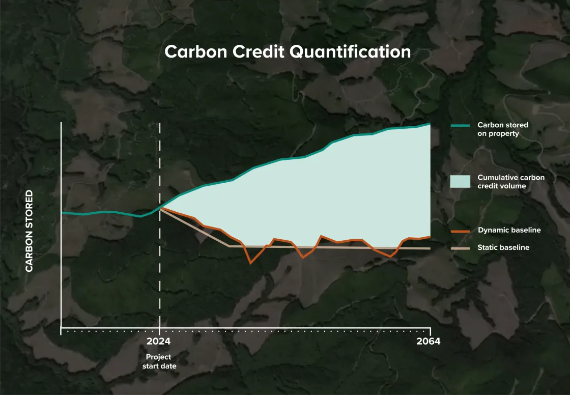
Dynamic baselines
Epoch™ evaluations bring a new standard of scrutiny to project baselines, which underpin credit eligibility. Intensive analyses of economic, regulatory, and environmental conditions during every project reporting period determine each project’s ongoing climate benefit.
Monitoring and alerts for carbon loss
Projects are monitored monthly to detect forest loss from fire, storm damage, disease, or unanticipated harvest events. This adds a new layer of security above and beyond our on-the-ground presence to ensure that any unexpected carbon stock losses are immediately reported and accounted for.
Accounting for the realities of forest management
During every reporting period, as frequently as annually, Epoch™ evaluates a series of key criteria related to forest management in and around a project. This determines whether the project’s current baseline, its hypothetical harvest plan, is still accurate. If it is not, the baseline and credit quantity are adjusted to reflect real world conditions.
Anew’s Dynamic Evaluation Criteria
Common Practice Silviculture
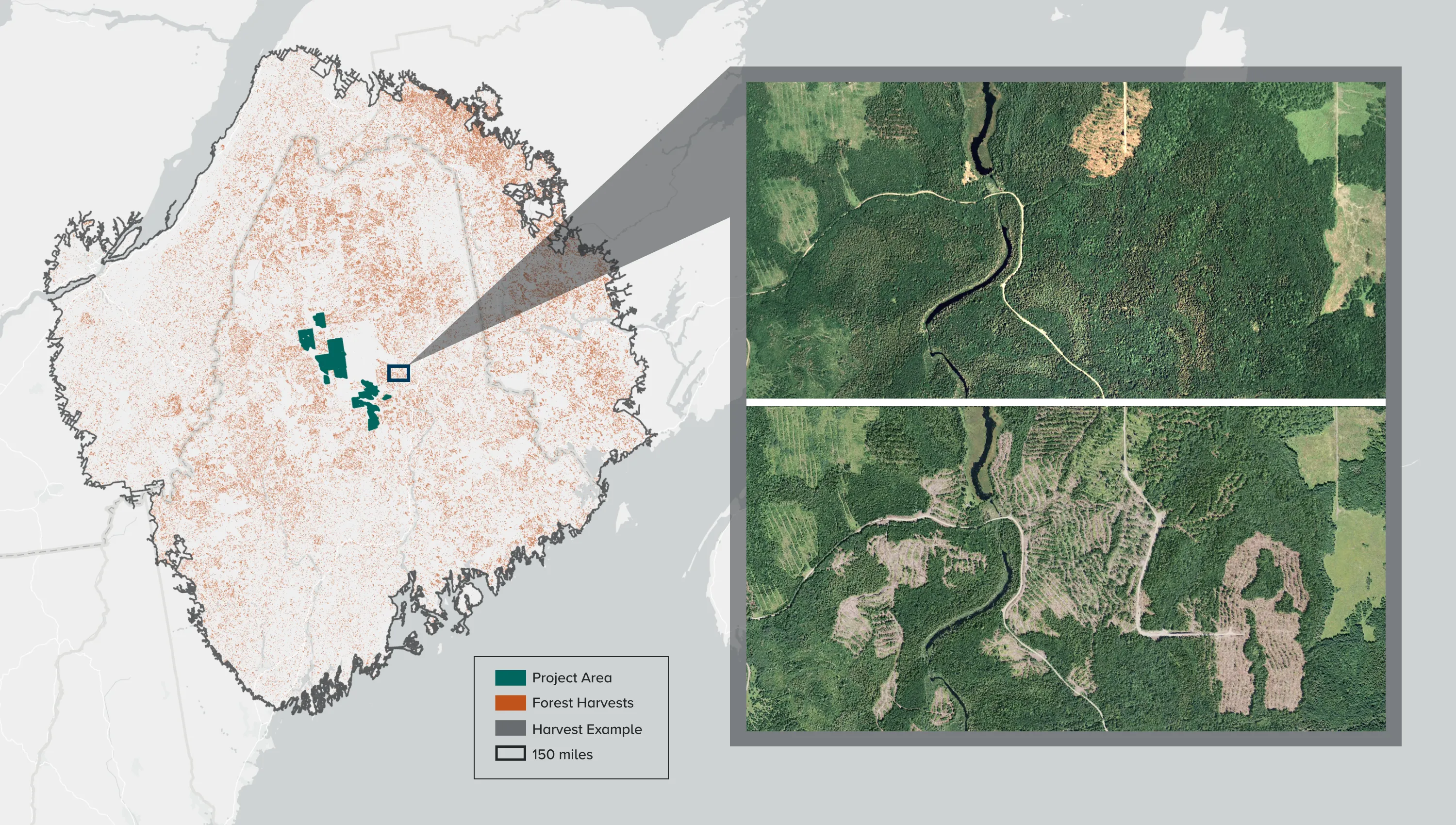
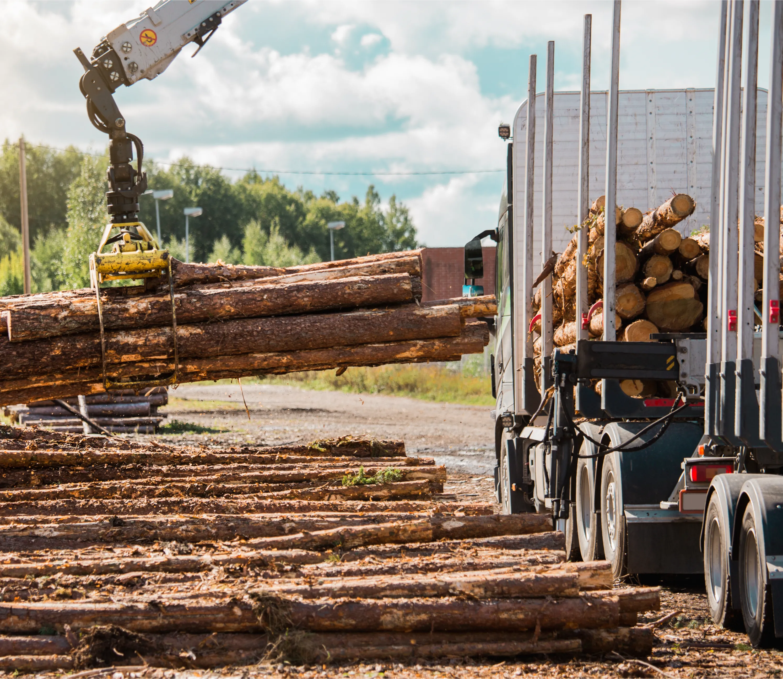
Anew utilizes Epoch™ to compare each project property to forest management practices occurring on similar sites within its relevant region for timber extraction, transportation, and processing. This involves a review of literature, interviews with local forestry professionals, and satellite substantiation of recent harvests based on cutting-edge AI technology and high-resolution imagery, capable of identifying harvest activity at the scale of single trees (.5-meter resolution).
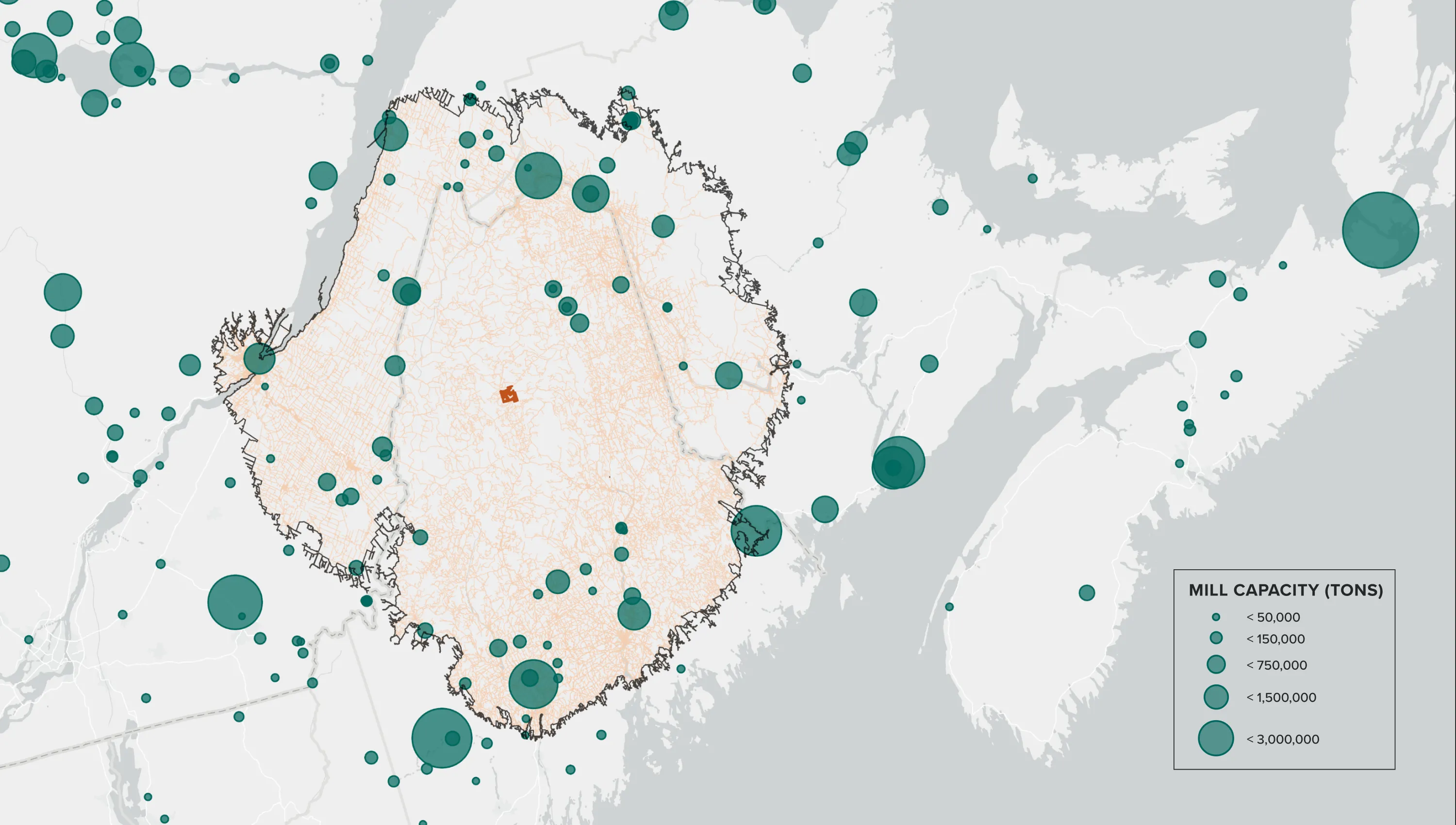
Regional Timber Market Capacity
Anew limits baseline harvest scenarios to strictly reflect tree species and size classes for which there is wood product demand within the feasible economic region for timber extraction, transportation, and processing. The relevant region is delineated based on each project’s proximity to facilities such as operational mills, ports, and rail yards.
Harvest Operability and Access
Anew limits baseline harvesting scenarios to forest stands that are accessible. While always initially assessed, under the dynamic evaluation approach this review of factors such as road accessibility, infrastructure degradation or improvements, and changes to land ownership is done at every project verification.

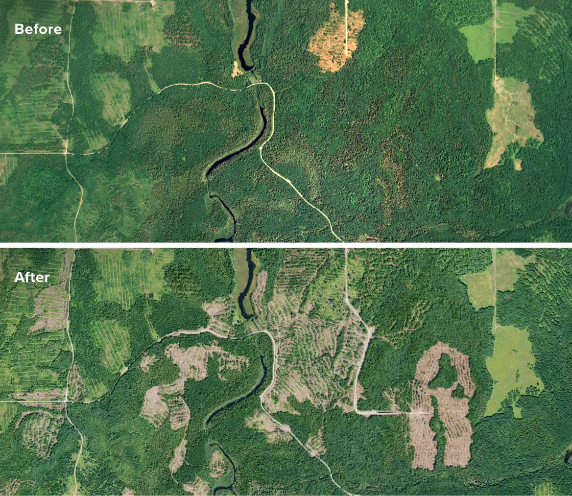
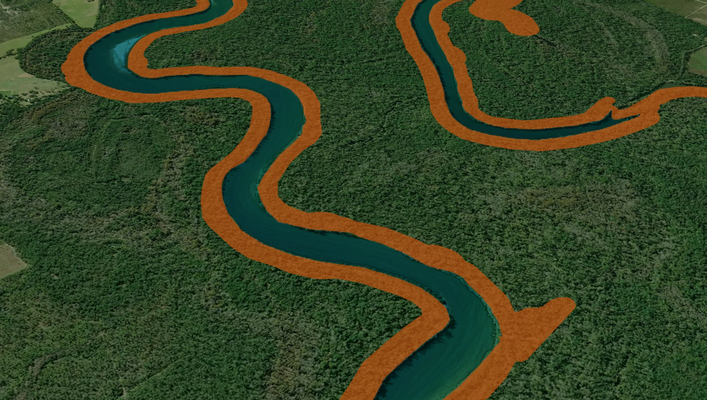
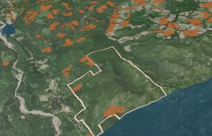
Dynamic Legal Review
All baselines must be updated to reflect legally permissible harvests and adhere to regional best management practices (BMPs). As one example, the image below depicts a newly expanded waterfront harvest exclusion zone, which would reduce the acres eligible for harvest in the baseline moving forward.
Ongoing Profitability Analysis
All baseline harvest scenarios must be financially advantageous. Credits are only generated in association with baseline harvests that would be feasible after accounting for factors such as current timber market conditions, stumpage prices, road building expenses, and maintenance and fuel costs for extraction and transportation equipment.

Deep dive: Epoch™ analysis of common practice silviculture
Common Practice Silviculture
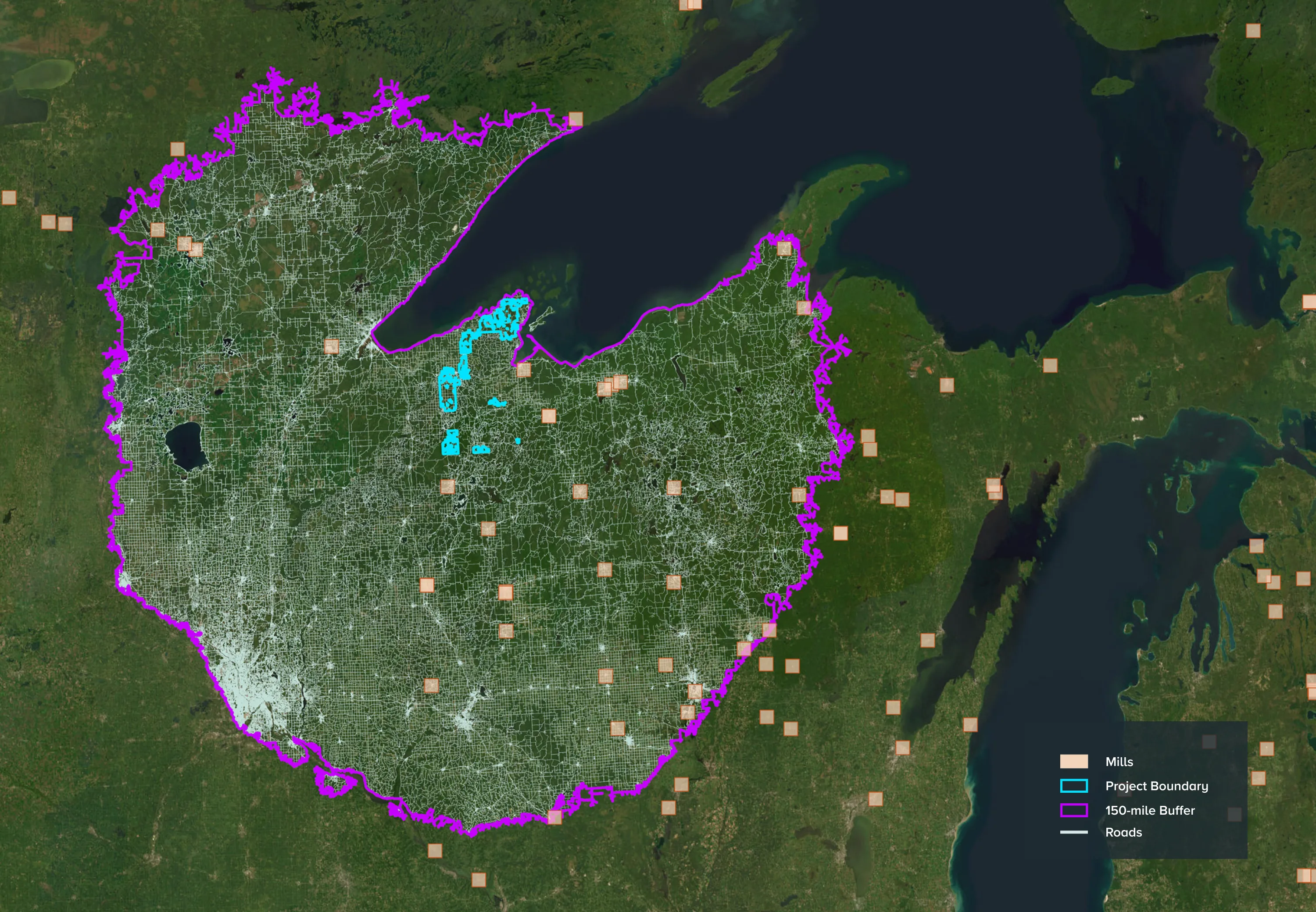
Reference region delineation
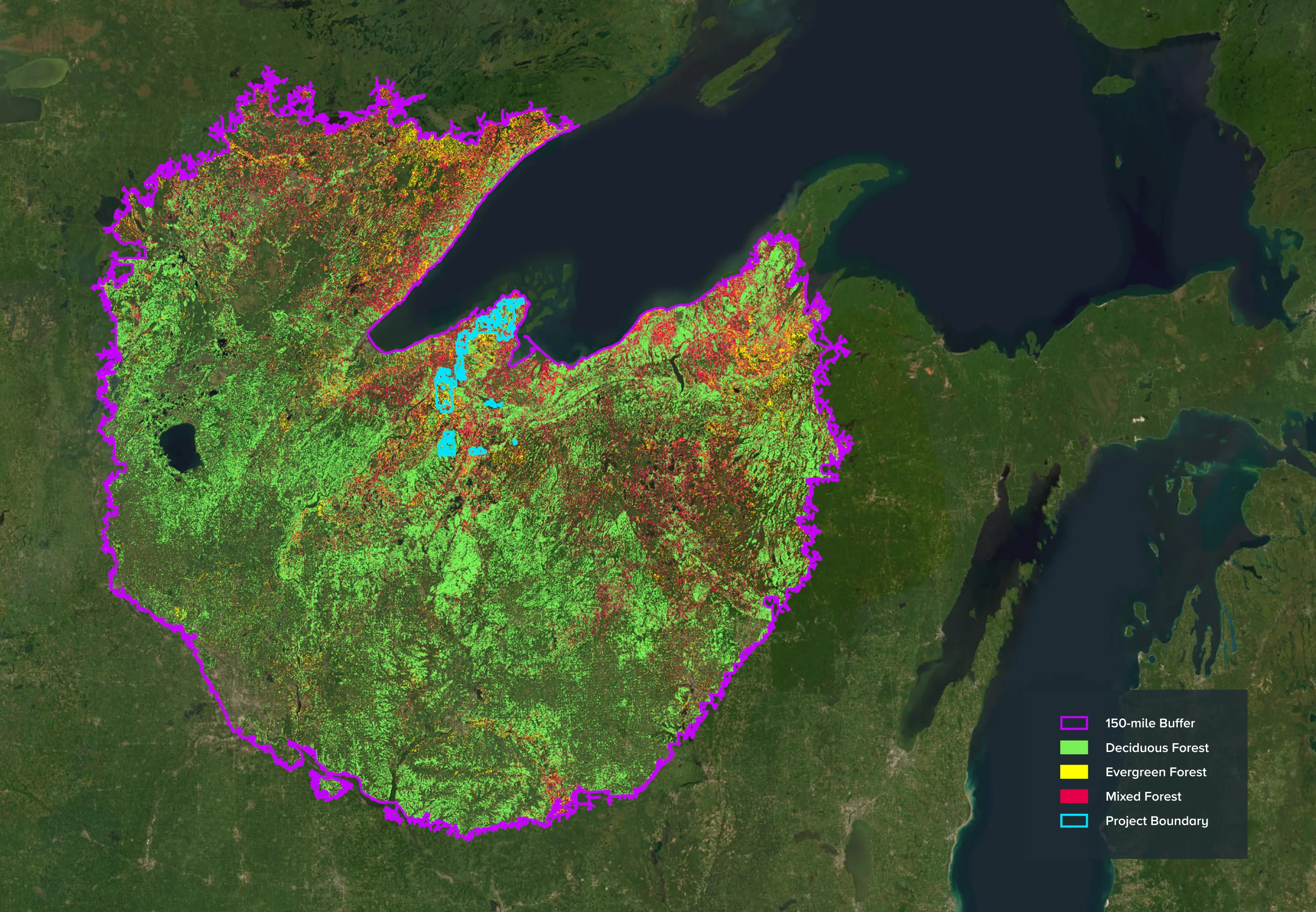
Map forest types within the region
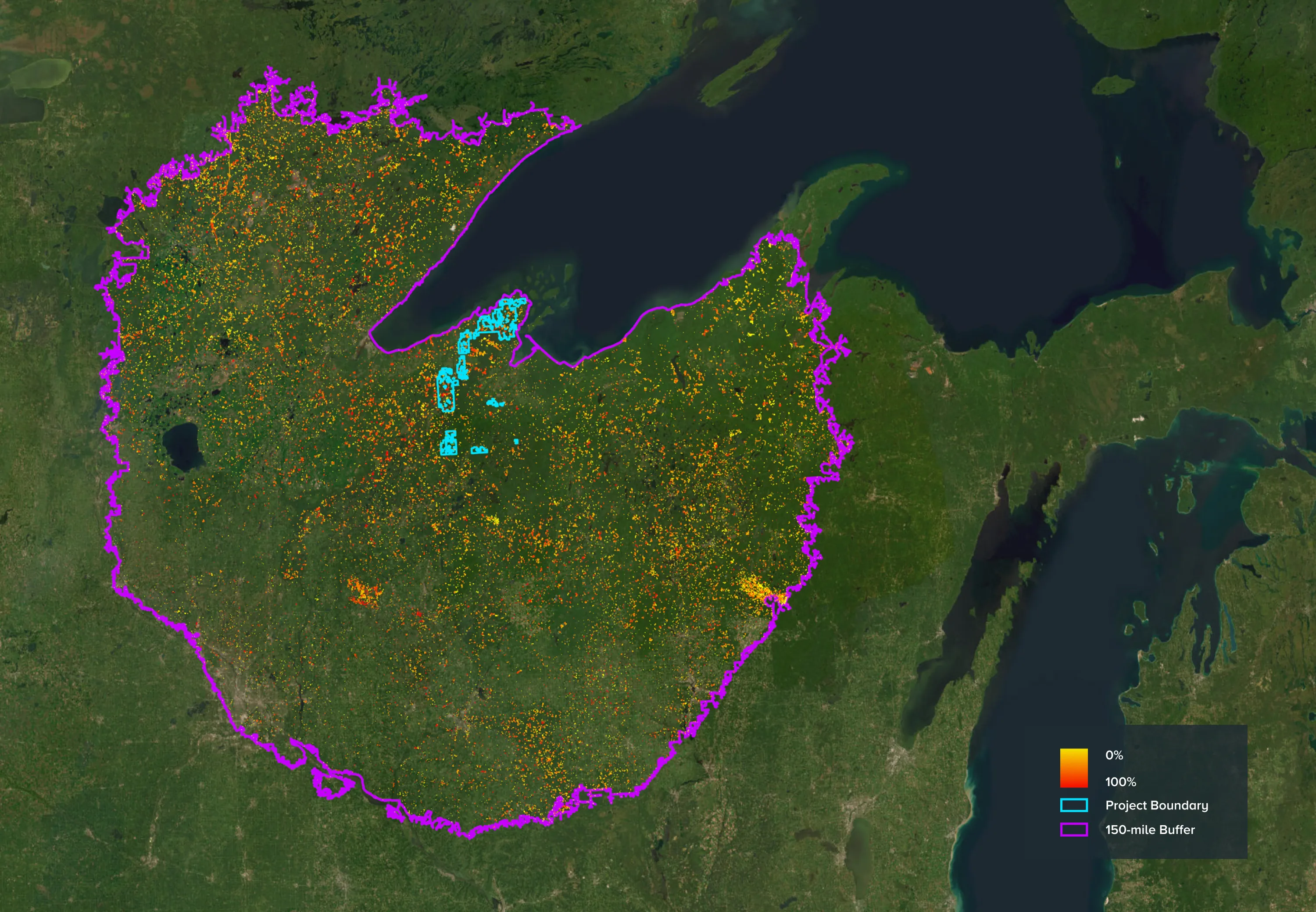
Regional harvest analysis
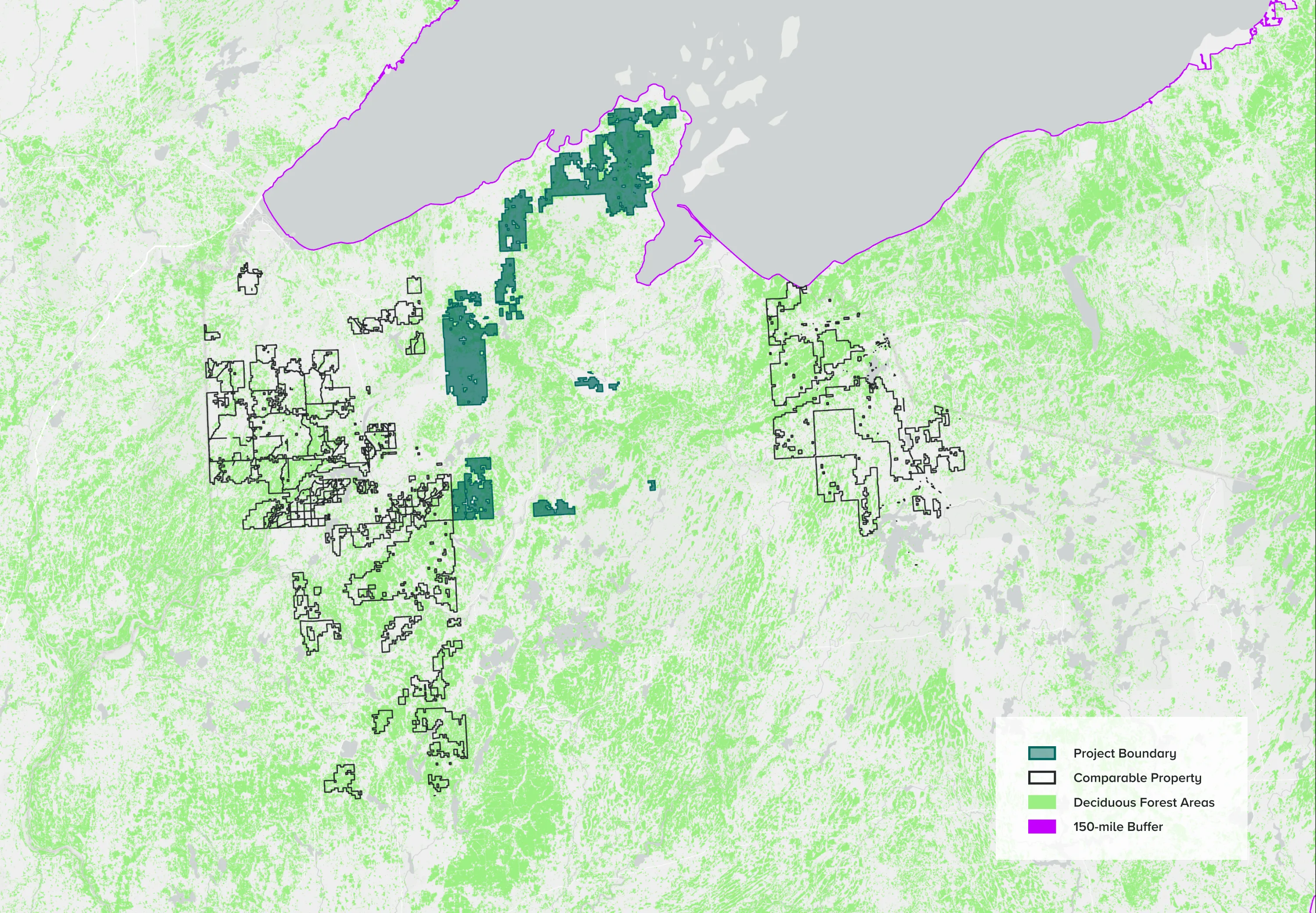
Identifying comparable properties
What might change a project’s baseline?
The following example scenarios would lead to an adjustment of the project’s baseline and credits issued in that reporting period.
A main bridge and road on the property have been washed out due to flooding in the previous year. Credits derived from areas of the property previously included in the hypothetical baseline harvests will be removed until the infrastructure is repaired.

Due to a nearby sawmill closure, there is no longer a market for beech sawlogs and the project’s 100 acres of beech-dominant stands would no longer be eligible for harvest in the baseline. This would decrease project crediting.
Stumpage prices for pulpwood in the area have decreased substantially due to changes in the local economic conditions. The EpochTM assessment concludes that harvesting activity for pulpwood is no longer financially feasible, warranting an adjustment to the baseline to exclude pulpwood harvests, and decreasing project crediting accordingly.

Collaborators and partners
Related content
- News
Anew Climate and Quinte Conservation Announce Issuance of First Canadian ACR Credits
Mar 7, 2024 - News
Anew Climate Sets New Standard for Forest Carbon Projects with its Epoch Evaluation Platform™
Feb 13, 2024 
Seeing is Believing at Empire Riverlands
October 5, 2023